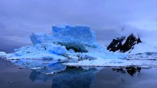
Image copyright
Vic Gill/BBC
US and European scientists are about to get a unique view of polar ice as their respective space agencies line up two satellites in the sky.
Authorisation was given on Tuesday for Europe’s Cryosat-2 spacecraft to raise its orbit by just under one kilometre.
This will hugely increase the number of coincident observations it can make with the Americans’ Icesat-2 mission.
One outcome from this new strategy will be the first ever reliable maps of Antarctic sea-ice thickness.
Currently, the floes in the far south befuddle efforts to measure their vertical dimension.
Heavy snow can pile on top of the floating ice, hiding its true thickness. Indeed, significant loading can even push Antarctic sea-ice under the water.
But researchers believe the different instruments on the two satellites working in tandem can help them tease apart this complexity.
Nasa’s Icesat-2, which orbits the globe at about 500km in altitude, uses a laser to measure the distance to the Earth’s surface – and hence the height of objects. This light beam reflects directly off the top of the snow.
Esa’s Cryosat-2, on the other hand, at around 720km in altitude, uses radar as its height tool, and this penetrates much more deeply into the snow cover before bouncing back.
- UK industry loses out in European satellite bids
- Space lasers track melting of Earth’s ice sheets
- UK takes £400m stake in satellite firm OneWeb
- Cryosat’s radar has the resolution to see the Arctic’s “floes” and “leads”
- Some 8/9ths of the ice tends to sit below the waterline – the draft
- The radar senses the height of the freeboard – the ice above the waterline
- Knowing this 1/9th figure allows Cryosat to work out sea-ice thickness
- The thickness multiplied by the area of ice cover produces a volume
- IceSat-2 does exactly the same as Cryosat but with a laser instrument
- The biggest uncertainty for both is the covering of snow on the ice
At present, scientists use really quite old climatology models to gauge the likely depth of snow cover when observing sea-ice in both the Arctic and the Antarctic. And while these models still work reasonably well in the north, they are next to useless in the south.
“Having Icesat and Cryosat work together will be like having this self-contained measurement system where we don’t have to rely on outdated data-sets anymore,” explained Nasa radar and laser altimetry scientist Dr Rachel Tilling.
“In future, we will more accurately be able to estimate the snow cover and therefore more accurately estimate the sea-ice thickness. In the Arctic, it will reduce our errors. In the Antarctic, I don’t think we really know yet just how cool this could be,” she told BBC News.
Antarctic sea-ice is highly variable in space and time.
In winter, it can extend to encompass an area touching 18 million sq km – more than the area of the land continent itself (14 million sq km). However, in summer, the floating ice will melt away to as little as 2-3 million sq km. But without an accurate assessment of the third dimension – floe thickness and thus volume – scientists are missing some key insights on the implications of this big swing in ice extent.
Image copyright
Michael Studinger/Nasa
“If you take for example the thicker sea-ice in the western Weddell Sea – this eventually gets exported into the southern Atlantic. And what you’re doing is essentially exporting freshwater (sea-ice incorporates little salt when it freezes) that’s going to affect the distribution of ocean salinity and ocean circulation when the ice ultimately melts,” said Dr Mark Drinkwater, the head of Earth & Mission Science at Esa.
“And if we can say something about the snow loading on the sea-ice then we can also say something about precipitation in Antarctica. That’s something about which we’re completely naïve. So we’d be getting both atmospheric and ocean insights.”
Image copyright
NASA
On Tuesday, managers at Esa gave final approval for the joint campaign known as Cryo2Ice.
Cryosat will fire its thrusters on 16 July to climb a few hundred metres higher into the sky. The manoeuvre, which will take a couple of weeks to complete, will not compromise the longevity of the mission as the spacecraft has ample fuel on board.
Esa’s Cryosat’s mission manager, Dr Tommaso Parrinello, told BBC News: “Icesat is quite a bit below us so we can’t go down to meet them, but by going up we find this incredible resonant orbit in which for every 19 orbits for us and 20 orbits for them – we will meet at the poles within a certain time lag. Basically, every 1.5 days, we meet over the poles within a few hours of each other and that means we can observe the same ice almost simultaneously.
“This could be revolutionary. We may never get the chance again to do this with two such different instruments.”
The closest we may get to this dual observation mode is a future radar spacecraft codenamed Cristal. It would map sea-ice in two frequency bands to pick up some of the differences in the way snow and ice will scatter back satellite signals, but the effect won’t be as pronounced as between Cryosat and Icesat.
Last week, Esa’s industrial policy committee gave the nod to Airbus in Germany to start developing Cristal. The mission could fly by the decade’s end if sufficient funds can be raised by the agency and its partner on the project, the European Commission.
Image copyright
Casper McKeever
[email protected] and follow me on Twitter: @BBCAmos
Read MoreFeedzy